Empowering Communities to Prepare for Climate Threats with Hyperlocal Data

ClimateIQ helps city planners and communities prioritize local adaptations to climate hazards, using advanced climate models and machine learning to identify the areas most at risk.

Follow us

Our Team and Partners

Mountainscape with Car

Why ClimateIQ?

Climate Change: A Growing Threat to Lives and Economies

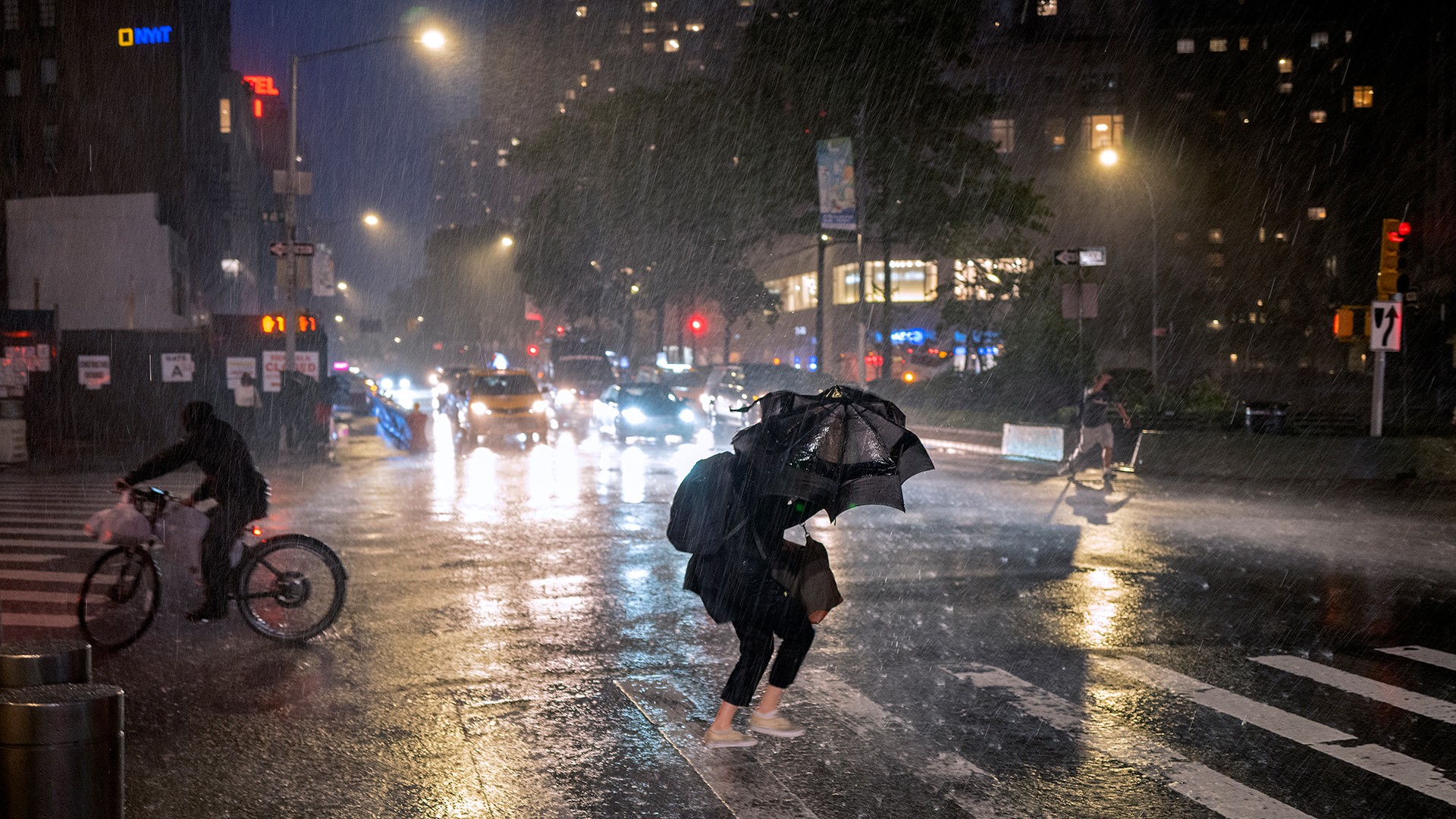
The majority of cities and communities globally lack information about climate hazards, endangering communities that are often the first to be impacted.

0

+ Million urban residents

are at risk from direct impacts of climate change on infrastructure, particularly in areas with poor housing and inadequate infrastructure.

0

X as many people

globally will be exposed to extreme heat in the future.

$

0.0

trillion dollar in saving

globally from investment in resilient infrastructure to avoid climate damage and reduce the risk of exposure for millions of people.

$

0.00

trillion

in annual urban economic losses is expected from extreme weather events by 2050 if no adaptive measures are taken.

Source: IPCC 2022

Mountainscape with Car

Why ClimateIQ?

Climate Change: A Growing Threat to Lives and Economies

The majority of cities and communities globally lack information about climate hazards, endangering communities that are often the first to be impacted.

0

+ Million urban residents

are at risk from direct impacts of climate change on infrastructure, particularly in areas with poor housing and inadequate infrastructure.

0

X as many people

globally will be exposed to extreme heat in the future.

$

0.0

trillion dollar in saving

globally from investment in resilient infrastructure to avoid climate damage and reduce the risk of exposure for millions of people.

$

0.00

trillion

in annual urban economic losses is expected from extreme weather events by 2050 if no adaptive measures are taken.

Source: IPCC 2022

Mountainscape with Car

Why ClimateIQ?

Vulnerable Communities Lack Access to Essential Climate Information

Communities at Risk Due to Lack of Climate Hazard Data

The majority of cities and communities globally lack information about climate hazards, endangering communities that are often the first to be impacted.

Technical Barriers Limit Access to Climate Data

While new data and technologies offer some promise, the lack of technical expertise, computational power, and funding make it difficult for communities to utilize.

Mountainscape with Car

Why ClimateIQ?

Vulnerable Communities Lack Access to Essential Climate Information

Communities at Risk Due to Lack of Climate Hazard Data

The majority of cities and communities globally lack information about climate hazards, endangering communities that are often the first to be impacted.

Technical Barriers Limit Access to Climate Data

While new data and technologies offer some promise, the lack of technical expertise, computational power, and funding make it difficult for communities to utilize.

Mountainscape with Car

Solution

A free, open access tool that is built on the latest climate science and advancements in machine learning.

ClimateIQ is designed to help communities understand and prepare for climate-related hazards, particularly under-resourced cities and vulnerable areas.

Solution

A free, open access tool that is built on the latest climate science and advancements in machine learning.

Solution

A free, open access tool that is built on the latest climate science and advancements in machine learning.

ClimateIQ is designed to help communities understand and prepare for climate-related hazards, particularly under-resourced cities and vulnerable areas.

Our Team and Partners

Features

Dashboard

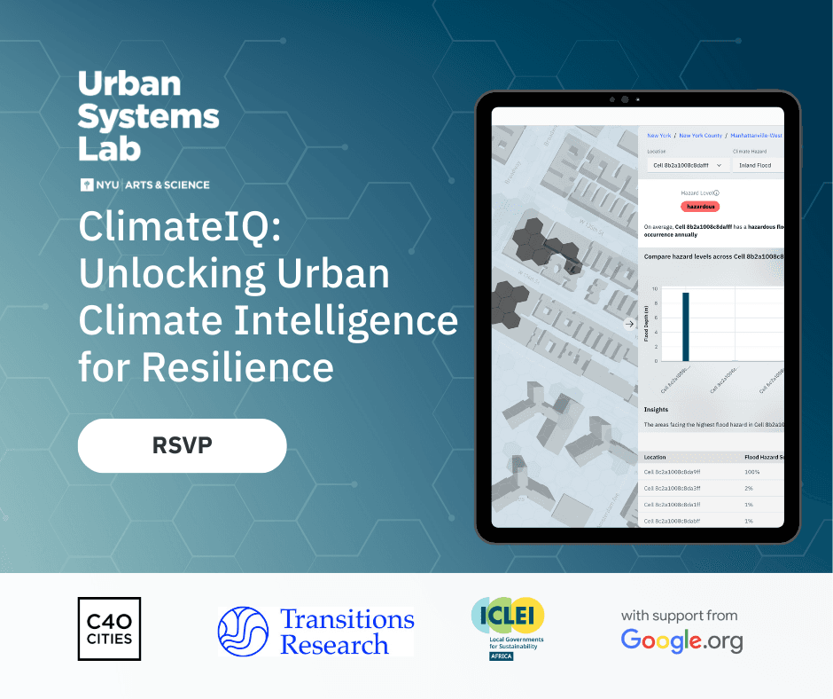
Through a freely accessible digital dashboard, ClimateIQ provides high resolution information for flooding from extreme rainfall and extreme heat conditions including air temperature, relative humidity and heat index.

Data Download / API

ClimateIQ's API empowers informed decision-making by delivering hyper-local climate risk data seamlessly into your existing workflows, aiding city planning, risk reduction, and disaster preparedness.

Features

Dashboard

Through a freely accessible digital dashboard, ClimateIQ provides high resolution information for flooding from extreme rainfall and extreme heat conditions including air temperature, relative humidity and heat index.

Data Download / API

ClimateIQ's API empowers informed decision-making by delivering hyper-local climate risk data seamlessly into your existing workflows, aiding city planning, risk reduction, and disaster preparedness.

How it works

ClimateIQ is based on an innovative, integrated multi-hazard modeling environment, which generates predictions for high resolution urban heat and extreme flood hazard exposure information.

ClimateIQ uses advanced physics-based models to simulate climate hazard exposure.

Machine learning models learn to reproduce the outputs of the physics-based models, speeding up climate hazard simulation time.

To make hazard information available to users, ClimateIQ partners with Climasens to provide a user-friendly dashboard and APIs for easy integration into existing workflows.

Our Users

ClimateIQ is for city and town planners, community based organizations, NGOs, and communities that need access to local climate information.


City and town planners

Community based organizations

Frontline communities

City and town planners

Community based organizations

Frontline communities

Benefits

ClimateIQ enables cities to prioritize investments in adaptation, preparedness, and climate justice goals for the most vulnerable.

Enhanced Resilience

ClimateIQ’s high resolution climate hazard data helps cities and regions develop robust resilience and climate adaptation strategies.

Enhanced Resilience

ClimateIQ’s high resolution climate hazard data helps cities and regions develop robust resilience and climate adaptation strategies.

Improved Emergency Preparedness

Accurate, hyper-local climate data allows city planners and responders to optimize operations and response plans, enhancing community safety.

Improved Emergency Preparedness

Accurate, hyper-local climate data allows city planners and responders to optimize operations and response plans, enhancing community safety.

Informed Decision-Making and Targeted Investments

Our interactive dashboard and APIs enable communities to identify high-risk areas, facilitating data-driven decisions and prioritizing investments where they are most needed.

Support for Under-Resourced Areas

ClimateIQ democratizes access to high-resolution climate data, aiding cities and regions lacking resources for comprehensive climate risk assessments.

Support for Under-Resourced Areas

ClimateIQ democratizes access to high-resolution climate data, aiding cities and regions lacking resources for comprehensive climate risk assessments.

Our team

The ClimateIQ team brings extensive experience in climate modeling, AI applications, data analysis, and visualization

Generous support provided by Google.org through their Impact Challenge on Climate Innovation.

FAQs

Browse some of our frequently asked questions. Please contact us if you still have additional inquiries or suggestions.

What hazards and scenarios will be available?

What resolution will you be able to provide?

Can I download the data?

Is it free?

How far into the future will exposure information be provided?

What data will you use, and what technical needs do you anticipate?

How long is the model training?

Are you planning to include social vulnerability data?

When will the tool be released to the public?

What is your long-term plan?

How can I get access to a demo?

What kind of time commitment can I expect from a partnership?

FAQs

Browse some of our frequently asked questions. Please contact us if you still have additional inquiries or suggestions.

What hazards and scenarios will be available?

What resolution will you be able to provide?

Can I download the data?

Is it free?

How far into the future will exposure information be provided?

What data will you use, and what technical needs do you anticipate?

How long is the model training?

Are you planning to include social vulnerability data?

When will the tool be released to the public?

What is your long-term plan?

How can I get access to a demo?

What kind of time commitment can I expect from a partnership?